Reefton to Haast

I travelled from Reefton to Haast in one day, however, to have a good look round you could quite easily take two or three days. A number of years ago I spent a couple of days travelling and exploring areas between Reefton and Hokitika with my daughter, so I skipped through that part on this trip. I will include some photos from my earlier trip for reference at the end of this post.
Kumara Junction, 15 minutes south of Greymouth, and 1 ½ hrs south of Reefton, is where most people will arrive on the West Coast via Arthur’s Pass. You turn left to head north to Greymouth, Westport, Karamea and places in between or turn right to head south to Hokitika, Franz Joseph and Haast.
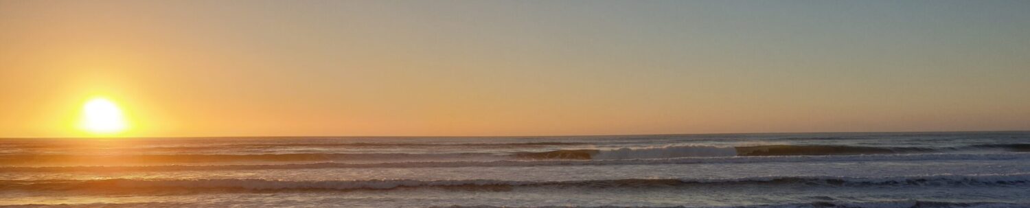
When my daughter and I took our trip, we stayed two nights in Hokitika to look round the area. Be sure to view the sunset from the beach as they can be spectacular. For more information on what to see and do, check out the Hokitika Visitor Information Site.
Now for my latest trip. First stop was at Lake Lanthe, the perfect place for morning tea. I have inherited my Mum and Dad’s old Thermos which comes with me on most road trips for just this very thing. Both of them loved a road trip as well. There are a couple of parking areas, toilets and a boat ramp for those that want to kayak or fish.
If you do plan on fishing you will require a fishing licence, which can be purchased on-line. Information on licences and limits etc can be found on the New Zealand Fish and Game website.


Further down the road after crossing the Whataroa River bridge, I just had to stop and take a photo of the stunning turquoise blue water. About 100m past the bridge on the left (as you head south) there is a turn off that will take you down a gravel road (in good condition and fine for all cars) to the river and to Glacier Country Scenic Flights. This is a great spot for a picnic lunch. There are toilets – though basic in nature.

Next stop – Lake Matheson – renowned for its reflecting views of Mt Cook, or Aoraki, New Zealand’s highest peak at 3,724m (12,218’) – but only on calm windless days. It wasn’t calm and still when I arrived – no reflection. The whole time I was there, Mt Cook was shrouded in cloud. That is her neighbour, Mt Tasman in the photo.
There is a large parking area hear, along with a restaurant, information centre and toilets.

Many people choose to stop in at Franz Joseph, however I didn’t stop as I’d been up to the glacier way back in the early 80’s and the glacier has receded a long way since then and I prefer to remember the glacier how it was. I would have stopped for a dip in the hot pools but they are currently closed, which is a shame as they are lovely.
At Bruce Bay I stopped to stretch my legs stopping in time to see a driver driving down the road on the wrong side at a great rate of knots! I tried waving them over to the correct side of the road but they ignored me and kept on going. I was shaking after they went through as I fully expected to come upon a serious crash further up the road. Thankfully this didn’t happen.
Remember folks – Keep Left – when driving in New Zealand.

There is a monument at Knight’s Point to commemorate the opening of the Paringa – Haast section of the highway that linked Westland with Otago. The road was started in the 1950’s and completed in 1965.
The story goes that Knight’s Point was named after the surveyor’s (Norman George) dog Knight. I have no idea if this is true, but it’s a great story and I’m sticking with it.


Not far down the road is Ship Creek. It is lovely estuary with a sandy beach. There are two short walks – 20 & 30 minutes that start from the car park. There are toilets and a viewing tower.
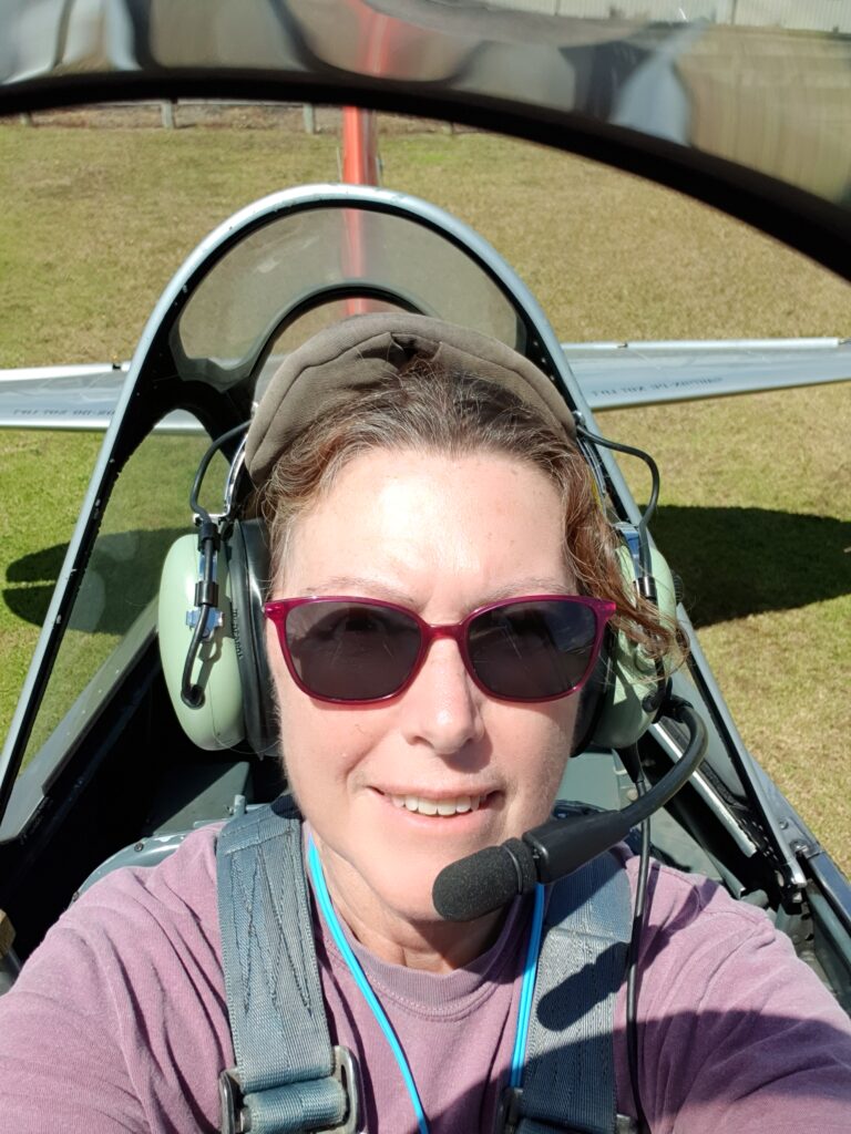
Once I un-loaded the car I went for a drive to Jackson Bay, another 20 -m 30 minutes down the road. The road into Jackson Bay was closed for some time due to slips after some heavy rain. It is still fine for any car to travel on.
The headland provides shelter from the prevailing wind direction, and here a fishing harbour has survived since the early pioneer days of seal hunting. It has been designated a World Heritage Area. Jackson Bay is one of only two known areas in South Westland regularly used as a nursery area by the rare Hector’s dolphin females and their calves. On the way back to the motel, I stopped at Neil’s Beach and saw two Hector’s dolphins not too far off-shore.
The only place to eat is The Crab Pot, which I’ve heard is very good, however, it was closed when I arrived. Seems to be open during the day. The website says 7 – days 11am – 3:30pm, though I’m not sure that this is guaranteed particularly after the peak Summer Season.
I was bummed, I didn’t get to eat there! I fancied a bit of fresh caught crayfish. It’s all in the timing.


The following photos are from my earlier trip with my daughter.

Sunset at Hokitika Beach.

- Hokitika Gorge – the lower swing bridge you see in the photo is now closed.
- Dorothy Falls – near Kaniere Lake
- Track to Kaniere Lake
- Blue Pools – Hokitika Gorge Walk
Discover more from On The Road and More
Subscribe to get the latest posts sent to your email.